← Home · Laboratory

Grain Size Analysis in Halifax: Sieve and Hydrometer Testing for Marine Soils

Together, we solve the challenges of tomorrow.

LEARN MORE →

A mid-rise project on the Bedford Highway stopped dead in its tracks last fall. The excavator hit a pocket of fine gray silt at three meters. Nobody knew if it would drain or hold water. Turns out it was a marine clay layer, classic Halifax formation. The geotechnical report had missed it because the grain size analysis only ran a coarse sieve. That changed everything. Now we run the full hydrometer by default. In Halifax, where Lawrencetown till sits next to harbor mud, you cannot cut corners on particle distribution. We have learned to combine sieve stacks with sedimentation analysis for every borehole near the harbor. It is the only way to catch those sensitive silts before the footing goes in. When we prepare a grain size curve, we also triaxial test the same sample if the fines content exceeds 30 percent, because that silt can lose strength fast under load.

A missing hydrometer test in Halifax harbor silt can turn a routine excavation into a half-million-dollar dewatering nightmare.

Methodology and scope

Halifax geology swings from granite outcrops on the peninsula to compressible organic silts in the old river valleys. The winter freeze-thaw cycle here is brutal. It turns poorly graded sand into a pumping mess under a foundation. A proper grain size distribution tells you the coefficient of uniformity and the curvature coefficient. Those two numbers predict frost heave potential better than any rule of thumb. We wash every sample through a 75-micron sieve before the hydrometer run. That step alone catches the difference between a well-graded glacial till and a gap-graded beach sand. The Dartmouth side often has cleaner sands from the old shoreline terraces. The Halifax side hides more silt. We read the curve differently for each location. The lab runs ASTM D6913 for the coarse fraction and ASTM D7928 for the fines, and we cross-check the hydrometer data with Atterberg limits when the plasticity looks suspicious. The result is a single continuous curve from gravel down to clay colloids.
Grain Size Analysis in Halifax: Sieve and Hydrometer Testing for Marine Soils
Technical reference image — Halifax

Local considerations

The South End sits on clean quartzite bedrock with a thin sandy veneer. You can almost design footings by eye there. Cross over to the North End near the old Africville shoreline and the soil profile flips completely. We pulled samples from a lot on Barrington Street last spring where the top two meters looked like brown sand, but the hydrometer revealed 65 percent fines below that. It was a buried marsh deposit. The contractor had planned for a standard spread footing. We switched them to a raft foundation after seeing the curve. Another case on the Dartmouth waterfront showed a clean medium sand on the sieve, but the hydrometer caught a tail of 12 percent colloidal clay. That fine fraction controlled the permeability. The client had to redesign the drainage system entirely. Grain size is not just a classification exercise here. It is a risk map for every square meter of the city.

Need a geotechnical assessment?

Reply within 24h.

Email: contact@geotechnicalengineering.vip

Technical parameters

ParameterTypical value
Sieve range (coarse)75 mm to 75 µm (ASTM D6913)
Hydrometer range (fine)75 µm to 1 µm (ASTM D7928)
Reported coefficientsCu (uniformity), Cc (curvature)
Sample mass for hydrometer50 g (dry weight, fines)
Dispersing agentSodium hexametaphosphate solution
Temperature correctionContinuous, per ASTM E100
Typical turnaround3 to 5 business days

Associated technical services

01

Sieve Analysis (ASTM D6913)

Mechanical shaking through a stack of sieves from 75 mm down to the No. 200 (75 µm). We wash the fines through and oven-dry the retained material. This gives the gravel and sand percentages, plus the D10, D30, and D60 grain sizes needed for uniformity and curvature coefficients. Ideal for Halifax glacial tills where the coarse fraction dominates the engineering behavior.

02

Hydrometer Analysis (ASTM D7928)

Sedimentation test using a 152H hydrometer on the minus-75-micron fraction. We prepare the sample with sodium hexametaphosphate, control the temperature bath, and take readings at 0.5, 1, 2, 4, 8, 15, 30, 60, 120, and 1440 minutes. This catches the silt and clay split that controls drainage, consolidation rate, and frost susceptibility in Halifax harbor sediments.

Applicable standards

ASTM D6913-17: Standard Test Methods for Particle-Size Distribution (Gradation) of Soils Using Sieve Analysis, ASTM D7928-21: Standard Test Method for Particle-Size Distribution (Gradation) of Fine-Grained Soils Using the Sedimentation (Hydrometer) Analysis, ASTM D2487-17: Standard Practice for Classification of Soils for Engineering Purposes (Unified Soil Classification System)

Frequently asked questions

Why do I need both a sieve and a hydrometer test for a Halifax foundation?

The sieve alone only tells you the sand and gravel percentages. In Halifax, many soils contain a significant silt or clay fraction that passes the No. 200 sieve. That fine fraction controls drainage, frost heave, and long-term settlement. The hydrometer is the only way to measure it. Skipping it on a marine silt site can lead to a footing design that does not match the ground reality.

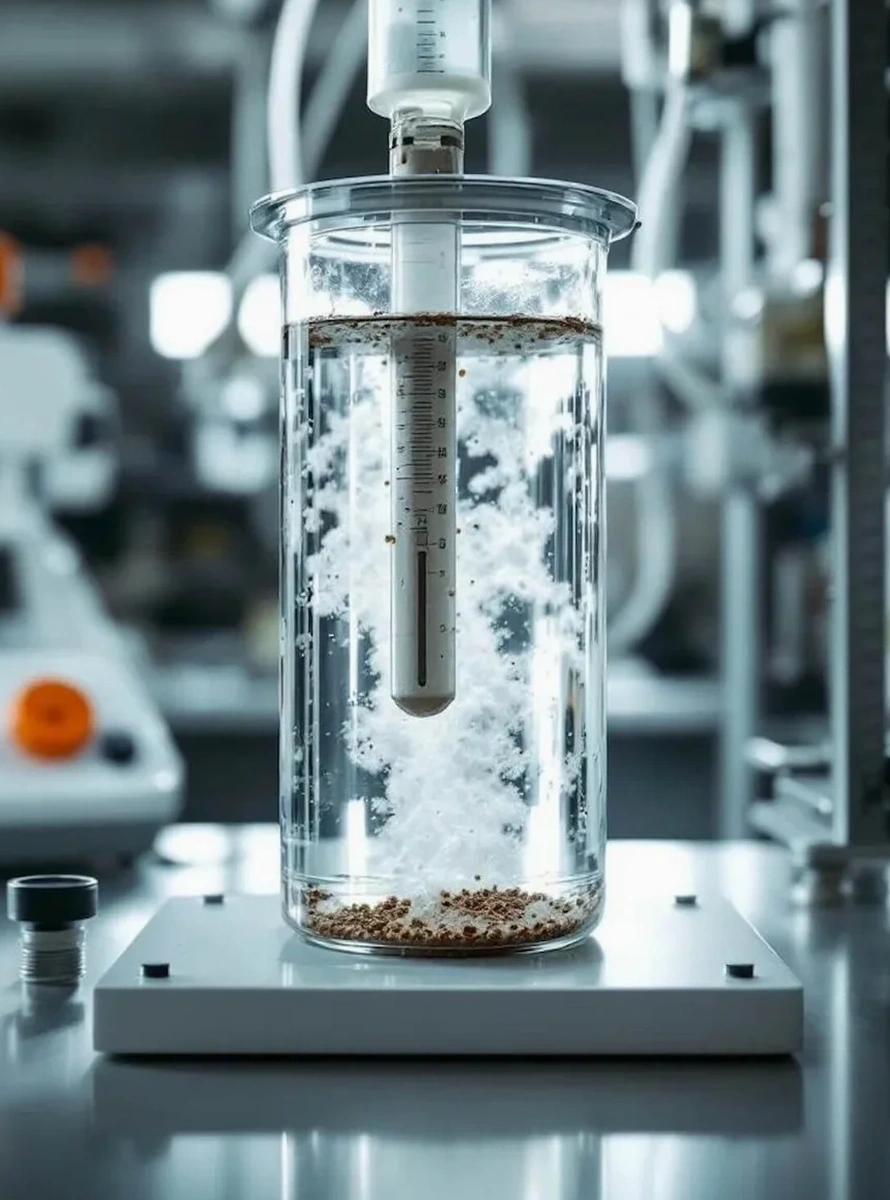
How much sample do you need for a complete grain size analysis?

We ask for about 500 grams of dry soil for a combined sieve and hydrometer run. For gravelly glacial tills from the Halifax area, we may need up to two kilograms to get a representative coarse fraction. We can work with bag samples or split-spoon samples from SPT drilling. The key is keeping the sample intact and not letting the fines dry out into hard lumps.

What is the typical cost for grain size testing in Halifax?

A combined sieve and hydrometer analysis in our Halifax lab ranges from CA$120 to CA$250, depending on whether it is a single sample or part of a larger geotechnical investigation package. The hydrometer test adds time because of the 24-hour sedimentation period. Rush turnaround is available at a premium.

How do I read the grain size distribution curve for my site?

The curve plots particle diameter on a logarithmic x-axis against percent passing on the y-axis. A steep curve means poorly graded soil, common in Halifax beach sands. A flat curve means well-graded material, typical of our glacial tills. The D10, D30, and D60 values let you calculate the uniformity coefficient and curvature coefficient. Those numbers tell you if the soil will compact well, drain freely, or trap water.

Does the test method change for marine clays versus glacial till?

The ASTM standards are the same, but the sample preparation changes. For marine clays from the Halifax harbor area, we dry the sample gently and use a mechanical disperser to break up the clay lumps without crushing the individual particles. For glacial till with a lot of coarse gravel, we run the full sieve stack first, then take only the minus-75-micron portion for the hydrometer. The two curves get mathematically combined into one continuous distribution.

Location and service area

We serve projects across Halifax and surrounding areas.

View larger map