← Home · Underground Excavations

Geotechnical Excavation Monitoring in Halifax: Instrumentation and Risk Management

Together, we solve the challenges of tomorrow.

LEARN MORE →

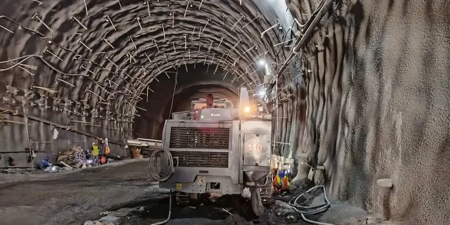
Excavation in Halifax means contending with two very different materials: dense glacial till overlying hard Cambrian-Ordovician slate of the Meguma Group. The transition zone between them is where problems start. When a shoring wall holds back saturated till above weathered bedrock, pore pressure can shift within a single tidal cycle, and the harbour's 2-metre semi-diurnal range influences groundwater levels well inland. The technical team deploys arrays of in-place inclinometers, vibrating-wire piezometers and optical survey targets to capture deformation before it becomes visible. A solid monitoring plan in this city must account for freeze-thaw action from December through March, which can temporarily mask or accelerate movement in the upper three metres of the cut. For deep foundations adjacent to sensitive heritage structures, the instrumentation package often couples with footings verification to confirm that design assumptions about bearing strata hold true once the overburden is removed.

Real-time inclinometer data from Halifax's till-bedrock transition routinely reveals deformation patterns that conventional observation would miss for weeks.

Methodology and scope

Monitoring on a Halifax site typically begins with baseline readings from a network of standpipe and vibrating-wire piezometers installed at multiple depths within the till and bedrock interface. These sensors record pore-pressure response to drawdown, precipitation events and tidal fluctuation. Inclinometer casings are grouted into HQ-diameter boreholes drilled at least three metres below the maximum excavation depth; readings are taken manually with a traversing probe every 48 hours during active cut phases, then weekly once the mat slab is poured. Automated total stations track prism targets mounted on soldier pile and lagging walls, delivering sub-millimetre displacement data that feeds directly into a cloud-based dashboard. When the excavation extends below the water table, a cpt-test campaign prior to shoring design provides the undrained shear strength profile and soil behaviour type classification that define the alert thresholds. Supplementary crack monitors on adjacent buildings and settlement points on buried utilities complete the picture, ensuring that the observational method stays anchored in measured reality rather than assumption.
Geotechnical Excavation Monitoring in Halifax: Instrumentation and Risk Management
Technical reference image — Halifax

Local considerations

Halifax's geological profile carries a specific risk: the slate bedrock is highly anisotropic, with foliation planes dipping steeply to the southeast. When an excavation exposes these planes, block failure along discontinuities can occur even when global slope-stability factors of safety exceed 1.5. The till above it contains lenses of silty clay that drain slowly and lose strength under repeated loading from construction traffic. Add the corrosive marine environment—chloride-laden groundwater accelerates deterioration of steel reinforcement in shotcrete and tieback components—and a monitoring programme that only checks for wall deflection is dangerously incomplete. Full-scale instrumentation must track groundwater chemistry, anchor load relaxation and vibration from nearby blasting simultaneously. Where shoring design incorporates high-capacity ground anchors, the field verification protocol frequently references the same load-testing discipline used in anchors certification, ensuring that creep behaviour under sustained load does not go undetected.

Need a geotechnical assessment?

Reply within 24h.

Email: contact@geotechnicalengineering.vip

Explanatory video

Technical parameters

ParameterTypical value
Inclinometer accuracy±0.25 mm/m per reading
Piezometer range0–1 MPa (vibrating-wire)
Total station precision±1 mm + 1 ppm
Crack monitor resolution0.1 mm
Typical monitoring frequencyDaily to weekly per NBCC Part 4
Reporting complianceCSA A23.3 Annex N thresholds

Associated technical services

01

Automated Real-Time Monitoring Systems

Deployment of total stations, wireless tiltmeters and multi-point borehole extensometers with cloud-based alerting configured to project-specific threshold values derived from the geotechnical baseline report.

02

Manual Instrumentation and Engineering Interpretation

Routine inclinometer profiling, standpipe piezometer readings and precise level surveys performed by a two-person field crew, with every dataset reviewed by a senior geotechnical engineer before distribution to the project team.

Applicable standards

NBCC 2015 Part 4 (Excavation and Foundation Requirements), CSA A23.3:19 Annex N (Monitoring of Retaining Structures), ASTM D6230-21 (Inclinometer Monitoring of Ground Movement)

Frequently asked questions

What is the typical cost range for geotechnical excavation monitoring on a Halifax infill project?

For a standard six-month monitoring programme covering a single-shored excavation in the Halifax peninsula, budgets typically range from CA$1,160 to CA$3,150 per month depending on the number of instrument types, reading frequency and reporting requirements. Complex sites with automated total stations and multiple inclinometer arrays will fall at the upper end of this range.

How does tidal fluctuation in Halifax Harbour affect monitoring data interpretation?

The harbour's semi-diurnal tide can produce measurable pore-pressure oscillations in granular fill and fractured bedrock within roughly 300 metres of the shoreline. The monitoring plan must include at least one barometric and tidal reference sensor so that apparent groundwater changes are corrected before being compared to alert thresholds. Without this correction, a rising tide can be misinterpreted as a stability problem.

What are the NBCC requirements for retaining wall monitoring during excavation?

NBCC 2015 Part 4 requires that shoring and excavation support systems be monitored for deformation and groundwater changes throughout construction. The standard references CSA A23.3 Annex N, which specifies minimum instrumentation types based on excavation depth and proximity to adjacent structures. For cuts deeper than six metres within Halifax's urban core, the code effectively mandates inclinometers, piezometers and survey monitoring with results reviewed by a licensed professional engineer at intervals not exceeding seven days.

Location and service area

We serve projects across Halifax and surrounding areas.

View larger map