In Halifax, the contrast between dense glacial till and fractured slate bedrock creates permeability profiles that lab tests alone rarely predict. We have seen projects on the Halifax Peninsula where design assumptions shifted completely once field data came in. The Lefranc test measures hydraulic conductivity in soils and soft rock at discrete intervals, while the Lugeon procedure quantifies water absorption in jointed bedrock—critical for understanding how water moves through the metasedimentary formations underlying much of the city. Both methods are run in boreholes during site investigation and provide direct, in-situ values that inform dewatering design, grouting decisions, and seepage analysis. For deeper bedrock assessments, we often pair these tests with seismic refraction surveys to map fracture zones before planning the drilling program. Our field crews operate year-round across HRM, including the challenging winter months when access in areas like Spryfield or Bedford requires specialized rig setup and heated water systems to maintain test integrity at ambient temperatures that regularly dip below -10°C.
A single Lugeon profile through fractured Halifax slate can reveal permeability contrasts of four orders of magnitude across a 20-metre interval—designing without that data is pure guesswork.
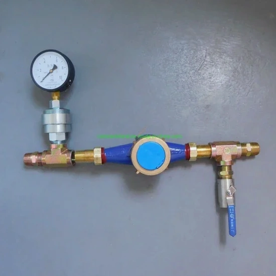
Process and scope
Halifax grew around the Northwest Arm and Bedford Basin, where historical development often placed foundations directly on weathered slate and till without systematic permeability characterization. Today, with infill projects pushing into former industrial lands and coastal margins, the role of field permeability testing has become central to geotechnical compliance. A Lugeon test is performed by isolating a section of borehole in rock, injecting water at stepped pressures, and recording the take over time—typically five pressure stages as outlined in ISRM guidelines and ASTM D4630. The result is a Lugeon value, where 1 Lu approximates 1 litre per metre per minute at 1 MPa pressure, helping engineers classify rock mass groutability. For soil layers, the Lefranc method uses either a constant or falling-head configuration, with results interpreted via the Hvorslev shape factor. When granular soils are encountered, we often recommend
grain-size analysis to correlate in-situ hydraulic conductivity with Hazen or Kozeny-Carman estimates, providing a cross-check that strengthens the hydrogeological model. Testing depths in Halifax typically range from 3 m to over 40 m, depending on whether the objective is shallow foundation drainage, deep excavation dewatering, or dam abutment assessment in areas like the proposed watershed developments near Lake Major.
Local considerations
A recurring mistake we see in Halifax excavations is relying solely on grain-size correlations or slug tests in monitoring wells, then discovering during construction that bedrock joints are delivering ten times the expected inflow. That scenario plays out frequently in the South End, where open joints in the Halifax Formation slate can carry significant water even when the rock matrix is tight. Skipping the Lugeon test in rock or misapplying the Lefranc test in stratified till produces dewatering plans that fail under real storm conditions. The cost overrun from emergency pumping, sediment control, and schedule delays far exceeds the cost of a proper field permeability program. In coastal fills near the waterfront, we often combine permeability testing with deep excavation monitoring to track pore pressure response during staged cuts, verifying that the measured k-values hold when the groundwater regime is disturbed. NBCC 2015 and local HRM bylaws require adequate groundwater control plans for excavations deeper than 1.5 m—and those plans are only as good as the permeability data behind them.
Common questions
When should I specify a Lugeon test instead of a Lefranc test?
Use the Lugeon test in rock—typically for bedrock deeper than 3 m where joints and fractures control permeability. In Halifax, that means the slates and greywackes of the Halifax Formation or the granite intrusions further inland. The Lefranc test applies to soils and heavily weathered rock where the medium behaves more like a porous material than a fractured mass.
How many test intervals do I need per borehole?
It depends on the geological profile. In a typical Halifax borehole with 5 m of till overlying 15 m of bedrock, we recommend at least one Lefranc test in the till and Lugeon tests at 3–5 m intervals through the rock, with closer spacing near the bedrock surface where weathering and jointing are most pronounced.
What is the typical price range for Lefranc or Lugeon testing in Halifax?
How do you prevent test errors in fractured rock?
We use pneumatic packers inflated to 1.5 times the maximum test pressure to ensure a reliable seal, and we monitor for leakage past the packer via a transducer above the upper seal. If water appears at the borehole collar during the test, the interval is re-set. Temperature compensation is applied to all pressure readings, and we run at least one repeat stage to confirm steady-state conditions.
Can permeability tests be done in angled boreholes?
Yes, both Lefranc and Lugeon tests can be performed in inclined boreholes up to about 30 degrees from vertical. In Halifax, we have run Lugeon profiles in angled holes for slope stability investigations along the Northwest Arm and for tunnel alignment studies where the joint orientation required intersecting specific fracture sets at an angle.